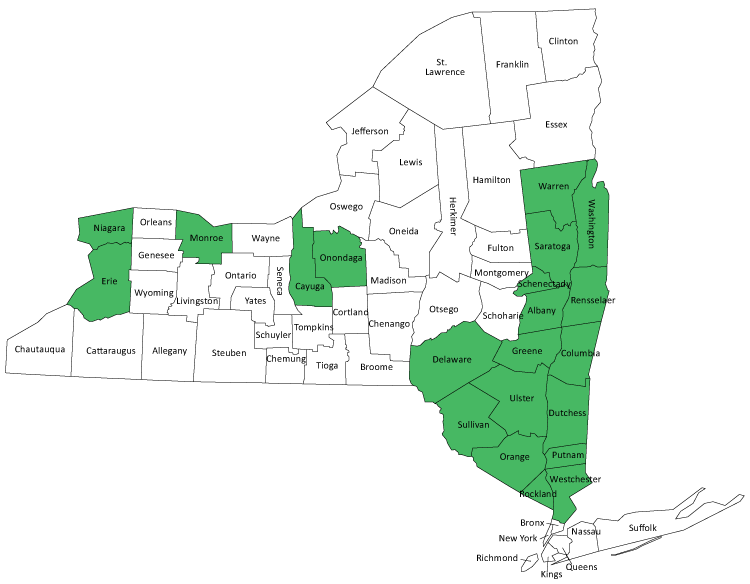
Fish Advisory Maps by County
These maps highlight public access fishing waters and provide anglers and fish consumers a visual guide to the different types of consumption advice. There may be other waters in your county with public access that are not highlighted in these maps.
The maps show advisory locations to the the best of our knowledge. Please contact HRFA@health.ny.gov if you are aware of any additional natural or man-made barriers preventing fish passage (that should or should not be included on these maps). We appreciate all feedback. These detailed maps are the first in a series that will be available over time.

Maps in List Format
| County | Detailed Map (pdf) | |||||
|---|---|---|---|---|---|---|
| No listings in this county | ||||||
| Albany | Albany Co Map | |||||
| Cayuga | Cayuga Co Map | |||||
| Columbia | Columbia Co Map | |||||
| Delaware | Delaware Co Map | |||||
| Dutchess | Dutchess Co Map | |||||
| Erie | Erie Co Map | |||||
| Greene | Greene Co Map | |||||
| Monroe | Monroe Co Map | |||||
| Niagara | Niagara Co Map | |||||
| Onondaga | Onondaga Co Map | |||||
| Orange | Orange Co Map | |||||
| Putnam | Putnam Co Map | |||||
| Rensselaer | Rensselaer Co Map | |||||
| Rockland | Rockland Co Map | |||||
| Saratoga | Saratoga Co Map | |||||
| Schenectady | Schenectady Co Map | |||||
| Sullivan | Sullivan Co Map | |||||
| Ulster | Ulster Co Map | |||||
| Warren | Warren Co Map | |||||
| Washington | Washington Co Map | |||||
| Westchester | Westchester Co Map | |||||